
La rando Malivigne Aventure
Medium
9.9km
+124m
Description
A path created by the students of CM1-CM2 of the school of Maligny to discover the history of their village and its surroundings: the church of Notre-Dame de l 'Assomption (XIIe-XVIIIe century), the halls (XIXe century), the castle (XIIe century); in Villy, the washhouse (XIXe century), in Lignorelles, the church of Saint-Martin (XIIe century); the vineyard and the panoramas on the Chablisian...
1. Leave the school car park and go down to the left "rue des écoles". At the bottom right, look at Notre-Dame Church and then, on the left, Les Halles. At the intersection, take a slight left onto Rue du Temple and walk down the entire street. Take the pedestrian crossings on the right, to cross the D91 road (heavy traffic). Then turn left and walk along the castle park. Go down to the right on rue du Moulin. Just before the next intersection turn right to the "children's secret passage".
2. Reach rue du Moulin and advance to the Grand Pont built in 1786. Go over it and continue straight on the aisles of Auxerroise Street then St Étienne Street (caution.)
3. Once you have passed the entrance to Villy, take the first left, rue du Serein. Continue for about 150m, pass a small bridge and then take the grassy path to the right a few meters later, leaving the coast that goes up to the left. Continue straight ahead and then cross a small bridge again that leads to the 1866 washhouse. Continue left on the shaded street (rue de la Fontaine) until the intersection with rue de la Genillotte. Turn left again and turn right onto the dirt road about 100m after the Villy exit sign. Take this route for more than 1 km.
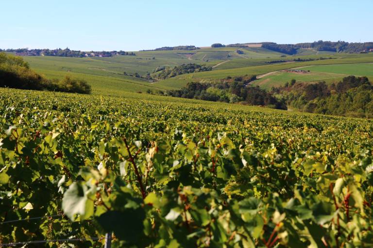
4. At the end of the path, turn right to the road to Beine, cross it and go straight up leaving the hunting hut (old lime kiln: chimney + quarry behind) on the right: Admire, throughout the ascent, the magnificent views of the vineyards! At the first crossing, a little before the end of the concrete gutter, turn right and then follow the sloping path on the left. Turn right at the next junction: the village is now visible in the distance on the left. At the next junction, turn left, follow the winding path to the asphalt road. Turn left and return to the town of Lignorelles. Turn left then right and enter the village. At the next intersection, turn right to go down Rue Auxerroise, towards Villy. Pass in front of the town hall - former school, cross the pedestrian crossing and then take the first left in the direction of Ligny-le-Châtel (D 124): rue des Carillons. Cross in front of the monument to the dead and then follow the Saint-Martin church (in the street of the same name) which was built in the 12th century before taking the second street on the right: Chemin des Essarts (just before the village exit sign).
5. Continue straight ahead and take the dirt road: you are facing the wind turbines. Continue along the path between the vineyard plots and admire the landscape. Cross the small paved road and continue straight on the path in front. At the next intersection, turn right, follow the winding path and then turn right again. Go down the path, sometimes paved, sometimes tarred, to the three large stones: take the grassy path straight ahead, leaving the paved path on the left. On the paved road, go down to the left. Pass the playground and then turn left again, in the direction of Maligny, in order to pass the town hall of Villy. Reach rue du Serein D and then the C by the same path as the way out.
6. Go up the Rue du Petit Cotat to the right. Cross the Grande Rue (on the protected passages on the left: heavy traffic) and continue it in front (small stiffener). At the end, turn left onto Rue de la Mairie and then turn right onto Rue de Bourgogne. Walk past the town hall. At the end of the street, turn right on rue de Chatillon then the first left on rue de Chanteprime. Finally, at the end, turn left, rue des Coteaux Fleuris to reach the starting point in front of the school.